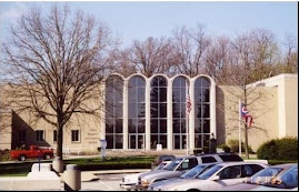
A few years back (more than I'd like to admit!) I did an exhibition in the Keller Gallery called "Letters Home: Stories from the Front." It featured letters written by soldiers and sailors in almost every war from the Civil War to the first Gulf War (which was an email).
Some were letters from our collection, and others were borrowed from the community. It was the very first time one of my exhibitions was picked up by the Associated Press and distributed across the country.
It was very emotional to read through all of the letters. In some cases they had re-sealed themselves, so I felt like I was opening someone else's mail from the past. Occasionally I had been told that the young man didn't come home, and I was waiting to see what the final letter in the stack said.
Sometimes the final letter from the soldier's commanding officer was the last piece of mail I read for that individual, informing his family of how he had died. I read letters written to parents, friends, and lovers. It was very difficult to figure out which letters to feature. I read over 400 letters during my research for "Letters Home."
The exhibition has been turned into a program which I have given at the Museum as part of our Soup at Six series, as well as various community organizations. Although I have read them several times, some letters still give me a knot in my throat.
Back to the original purpose of this post.
I first met Bea McPherson while collecting letters for the exhibition. During World War II, her then-fiance Jim (known as "Bill") was a Marine, and she was a mapmaker. Military censors would cut out or black out any specific references to location, so before he left they devised a secret code so Bea would always know where he was.
He would put an unobtrusive slash mark across the top of some the individual letters in the words he wrote. If you read them from top to bottom, it would spell out a clue for Bea so she could figure out his location:
 |
| The circles are mine. The original letter has only the slash marks. There are more pages of this letter, but I'm still not sure what clue Bill was sending Bea with this one! |
 |
| The phrase "any we took" refers to the island "Enewetak" in the Marshall Islands. The average person would most likely have missed this reference, but Bea knew exactly what he meant. |
 |
| Bea with Allen Anderson, who had been searching for a female WWII mapmaker for two years before he found her. |
It has been delightful to get to know Bea. Sadly, her husband passed away a few years after we did the exhibition. I was glad to be able to honor him as a Stark County veteran while he was still around to enjoy the recognition.
Bea has donated many artifacts over the years, and I'm always glad to be able to chat with her for a little while when she drops them off. When I read the article, I was proud to be able to say that I know her!


No comments:
Post a Comment